From: Hebden Bridge to Worsthorne
Distance: 13m / 21km
Cumulated distance: 571m / 919km
Percentage completed: 55.55
Today was an absolutely glorious day. It was the hottest day of the year so far and the sun is still shining now at 6. I suspect my friend Liz has brought it with her, from London .. she’s generous like that. I have a couple of days with her and she’s guaranteeing that it will be even warmer tomorrow.
I wanted to show her a little of the Rochdale Canal and so we headed back south along the towpath. Yesterday, I’d seen it through a film of drizzle but today was already a lot brighter by the time we started walking.
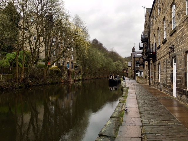
Walking back south on the Rochdale Canal
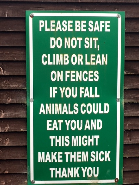
Couldn’t resist this one ..
There was a link path between the canal and the Pennine Way which eluded us for quite some time. Liz however, is not a woman who minds talking to strangers and asking them for directions, so after consulting the local mechanic we set off across the railway line, up the hill.
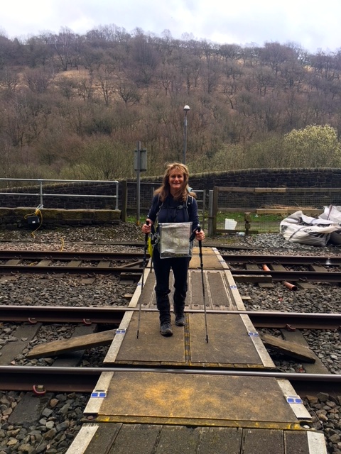
Crossing the line
We joined the Calderdale Way, which after a stiff climb past farms, took us to Great Rock. We paused, not only to catch our breath, but also to marvel at the views of upper Calderdale, with Stoodley Pike, the peace monument on the other side of the valley. Stoodley Pike features in a story associated with Great Rock. Legend tells how God and the Devil looked out over Hebden Bridge from Stoodley Pike and decided on a wager. If the Devil could step in one stride from the Pike across to the Great Rock on the other side of the valley, he could have the souls of the little town in the valley. He failed, but only just. His hoof landed on the rock .. which is also known as Devil’s Rock .. but slipped, and he lost the bet. Apparently, you can still see the imprint of his hoof on top of the rock but neither of us was game enough to scramble the last few slippery steps.

Liz almost at the top of Great Rock
There were several more peaks and troughs to negotiate before we joined the Pennine Way. We met several other walkers who all urged us to visit May’s for a cuppa and a piece of cake or a pie. It was not far out of our way so we decided to make the pilgrimage. We were not disappointed.
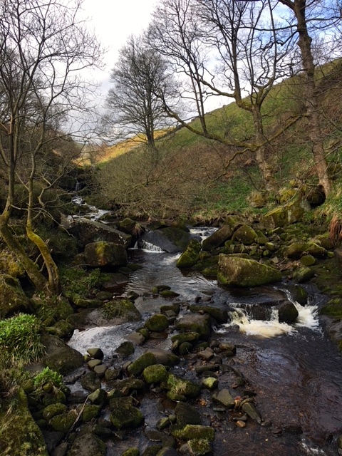
Along the way to May’s
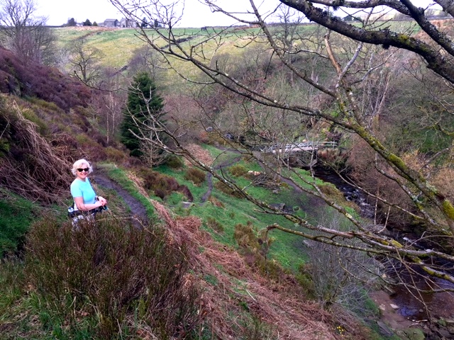
Just one more down and up before coffee
After a fine pitstop at the hospitable May’s, where incidentally there were some of Tony’s legendary custard creams on sale, we strode out to eventually join the Pennine Way. For the last year I have been gathering horror stories from various walkers of the dangers and hazards of this the UK’s oldest National Trail .. tales of sinking in bogs up to the waist and getting horribly lost in fogs, which descend with alarming rapidity. It’s wasn’t without apprehension that I joined the path.
According to Paddy Gillon, writer of walking books, the Pennine Way is ‘a long and arduous upland trail, often crossing remote moorlands and hills, suitable for fit and experienced walkers. There is seldom much shelter from inclement weather’. It’s also remarkably lacking in accommodation in parts, unless you’re a fan of rude bothies and ‘basic campsites’. The path runs all the way from the Peak District to the Cheviot Hills in the Borders.
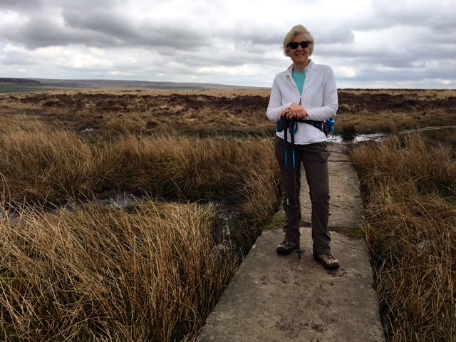
Famed Pennine Way with flagstones across the peat bogs
Today, however the weather was lovely and anyway I was just flirting with the PW, taking a cheeky look-see. We only walked on it for a couple of miles before returning to the familiar Pennine Bridleway. I do have to mention the delightfully named trio of places which we passed close by: Pisser Hill, Pisser Clough and Pisser Rough. Tickled my fancy!
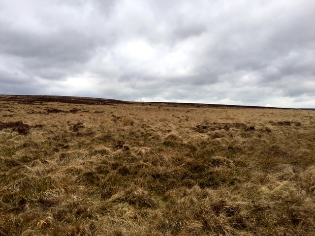
PW terrain
The photos really do not do the landscape justice. The wide expanses of moor were breath-taking and the song of lapwings was beautiful.
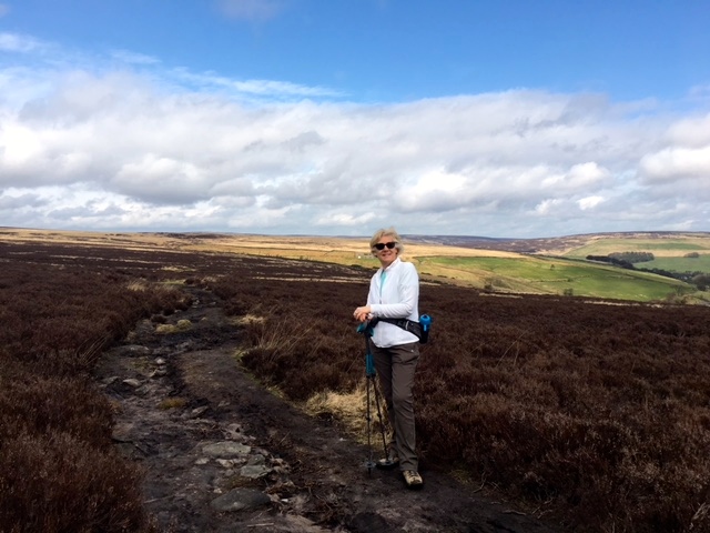
Liz in her element
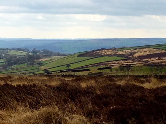
Expansive views
After we passed Gorple Lower Reservoir, the compass read due west for several miles. I could have planned to walk north west on the PW but then accommodation would have become a problem, as there’s nothing that has a bed nor serves white wine for a good deal further on. The vistas which opened up before us were stunning, so there was no complaint that we were not walking north.
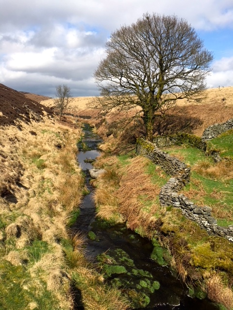
Just before Widdop Reservoir, close to Wicking Slack .. don’t you just love the names!
There was a long and steady climb along the side of Widdop Reservoir. By mid-afternoon the sun had really come out and for the first time on my journey I could feel its warmth. Wow, did it feel good.
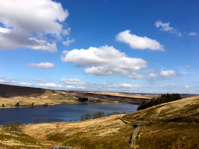
Looking back down over Widdop
Half way up the hill, in a completely inaccessible place, we came across the top of a car. It was truly bizarre and we couldn’t begin to work out how it had arrived there.
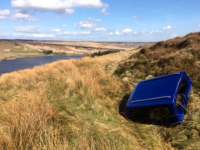
Fly-tipping extreme
Passing The Brinks and Shuttleworth Moor we eventually came to Gorple Stones, the dramatic gritstone outcrops which dominate the landscape.
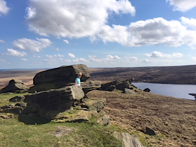
Gorple Stones overlooking Gorple Upper Reservoir
I had tea in my flask so we decided to take a seat on the springy bracken and share the parkin Liz had bought at May’s shop in the morning. Gentle reader, this cake was nothing short of orgasmic and we oohed and ahhed as we devoured every last crumb. I don’t think I have ever eaten anything finer. I’m not at all surprised that May receives phone calls from purchasers of parkin, demanding to know where they can buy more. It’s addictive.
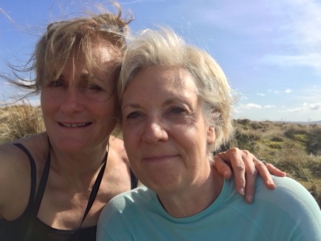
Parkin ecstacy
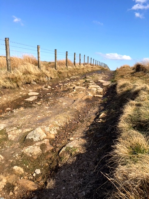
Looking back up the hill
Tearing ourselves away from our very comfy little possie in the bracken, we walked downhill until we reached Gorple Road and the way to Worsthorne, our stop for the night. The light had become golden, as it always does at the end of the afternoon and judging by the flower displays in the village, spring looks to have truly sprung.
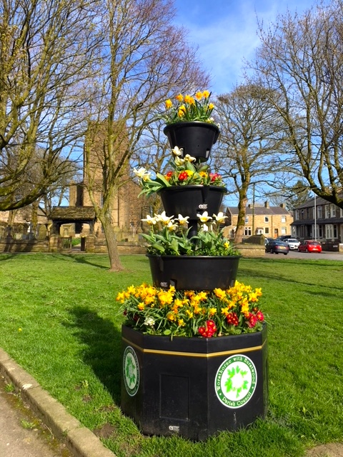
Blooming Worsthorne
Black Dog Tails
Orlando rescued his owner who fell on the subway tracks and wouldn’t leave his side in hospital.
![]()


How is your weight doing?
Probably carrying more like 10kg now ..
Well it looked like it was cracking flags with you today!
You’ve lost me there!
‘Fly-tipping’! – that’s sculpture up here in Lancashire.
I stand corrected!!
I am loving your attention to the rocks, Jules. As if the wildlife and landscapes weren’t enough, we get to peek at the geology too. So happy to see a sunny, warm day come your way – you deserve it!
So wish I had you and Doug with me to explain them all! Great being warm today.
Your photos today are sublime Jules – what a difference the sun makes! And the views – they go on forever. The names, the names, love the names! Lots of love XX
You’re the best, Frannie! So much easier to take good photos when the sun shines. And yes the names are amazing. I think they would be my desert island luxury .. I could spend months poring over them. xx
A wonderful day for you Jules and so much better when you can share the joy. I think the sinking peat bogs of the PW are all paved now so no danger there but the mist and capricious weather on the high Pennines will, at times, test walkers. When I see some of your photos I feel very happy. The colours, the sky and the rustic scenes … just beautiful. Yes, enjoy every moment. It is such a privilege to have the time and means to experience Britain ‘aller a pied’. xx
It really was beautiful, Marilyn and so good to see the famous PW at last! xx
Love seeing you in the sunshine with no need for gloves, jacket and hoodie. Bring on the sun and warmth!
It was glorious, Angie! x
I think you were referring to Paddy Dillon? That is all hype about the Pennine Way. There is nothing more arduous on it than the terrain you have walked in this post. You have already shunned its less interesting introduction and if you join it at anytime from now I’m sure you will have no problems and it is a very fine walk. Of course because your main objective is LEJOG you can pick and choose as you want.
Very comforting, Conrad .. thank you.
Jules , spring is here .. yeah !!
I smiled when I saw blue sky and could feel the warm sun on your bare arms , so happy for you that you are no longer trekking in the cold rain,pushed by blizzard , having to wear gloves, beanie, polar fleece and gaitors ( which I have been debating , should I buy some or not ? ) xx
Just be careful not to speak too soon, my friend!! Loved the sun yesterday but was back in waterproofs today. Gaiters .. I have found them extremely useful but mostly for keeping mud off my trousers. They barely weigh anything though, so you could go ahead and bring them. Not long now .. xx