From: North Petherton to Long Sutton
Distance: 15m / 24km
Cumulated distance: 274m / 441km
Percentage completed: 26.6
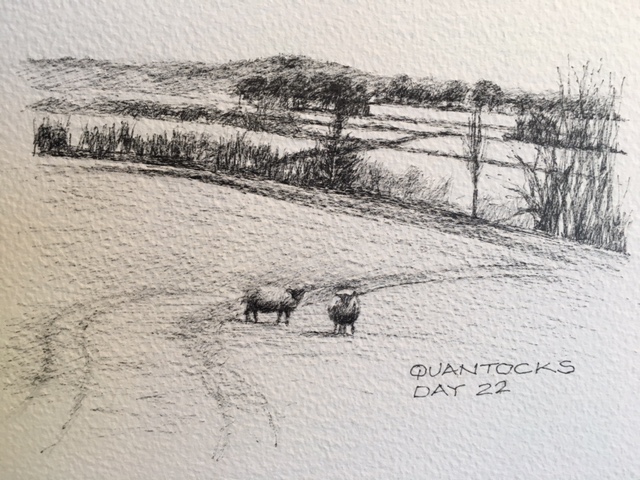
I really missed my friend’s chirpiness today. Especially as it was a day totally without mud and on the flat, which I know she would have loved. The sun shone warmly and I didn’t put a foot wrong along the Macmillan Way West, until the last field into Long Sutton. In many ways it reminded me of the Thames Trail that I walked a couple of years ago. I followed the River Parrett for most of the day. And I was following the river upstream, as I did when I was ‘walking backwards’ to the source of the Thames in Gloucestershire.
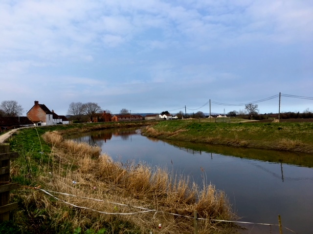
River Parrett
There’s something about following the path of a meandering river which forces you to mentally slow down and contemplate. You just can’t rush it’s path and I find it reassuring to have it as a constant companion by my side. I remember really missing the presence of the Thames when I finished walking it’s trail. Rivers have their own life, attracting a unique wild-life community. In that way, the River Parrett was reasonably quiet until later in the day when flocks of swans made it their home. Come spring I’m sure it will be teeming with birds and their young.
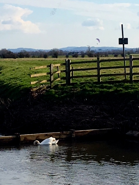
Fishing swan
My route today was through the Somerset Levels, an area known in England for drastic flooding. It was particularly severe in the winter of 2013/14, although flooding has been recorded since the Middle Ages. The Levels are a low-lying area around 3 to 4 metres above mean sea level. People have attempted to drain the area for hundreds of years. Drains and artificial rivers have been built and pumping stations installed .. in fact I walked between the River Parrett and the man-made Wookey drainage system for much of the day. Embankments, pumping stations and sluices were common features of the day.
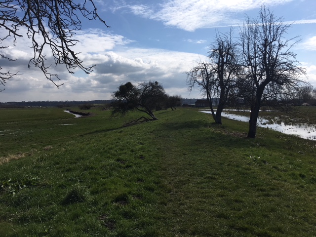
Embankment and drainage safeguards
I walked through the village of Moorlands which was badly affected in 2013, with most of the population having to abandon their homes for several weeks.

Some places remained abandoned
Before I got into the Levels proper, I walked past many farms. Agriculture and the growing of teazels are mainstays of revenue in the area apparently.
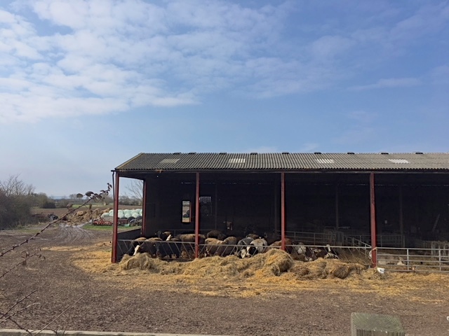
Farm along the way
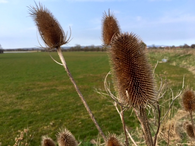
Teazels
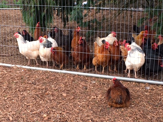
The one that got away .. but came back

Not always welcoming .. but with good reason
As I made good progress I decided to stop in Burrowbridge at The King Alfred pub for a bite to eat. And it being Sunday there was the tempting option of a roast! The inn lies sits on the river bank, in the shadow of Burrow Mump.
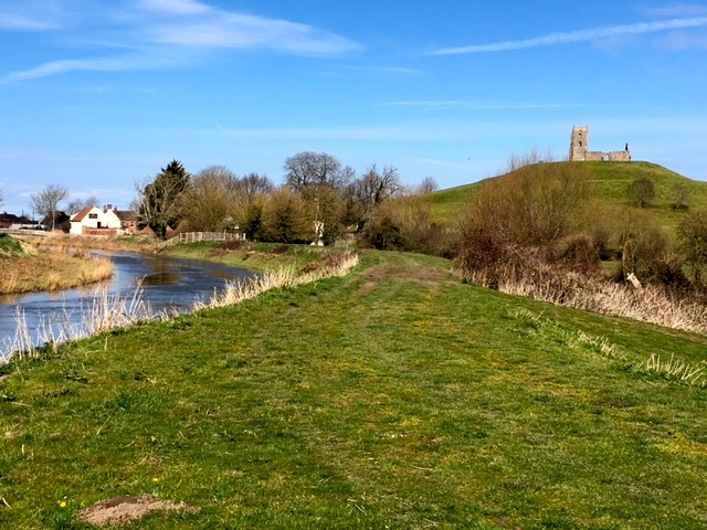
The King Alfred and Burrow Mump
I can hear you asking, ‘what on earth is a mump’! Although the area is underlain by the much older Triassic age, formations such as Glastonbury Tor and Burrow Mump would once have been islands, protruding from surrounding water. A ‘mump’ is quite simply, a hill. On it’s summit there is now a war memorial dedicated to the men and women of Somerset who gave their lives in the first and second world wars. But before it became St Michael’s church in the 19th century, it had also been a medieval church and before that a motte castle. The day was so clear that at one stage I could see both Burrow Mump and Glastonbury Tor from the river.
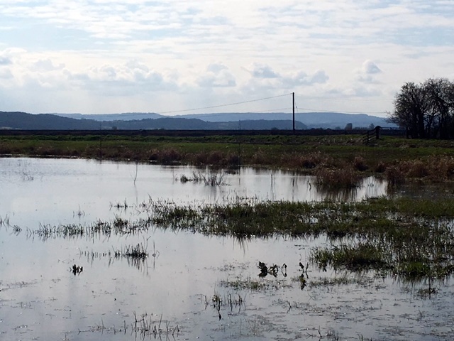
The Levels
As the day wore on it became clear just how flooded the area could become. My feet remained dry because of the embankment built along the river path, raising it high above the water. I continued to enjoy following the wandering path of the river, being able to see for miles around. At one stage I inadvertently disturbed a nesting swan.
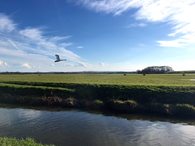
Swan taking flight
At six o’clock I turned away from the river to cross the final, not so big, field into Long Sutton, where the Devonshire Arms awaited me. Forty-five minutes later, with exceedingly wet feet, I arrived. Being so flat I couldn’t see that there were numerous man-made ditches, cross-crossing the field .. all filled with water. Jumping across the first two was just about ok but then the next four or five were wider and meant I had to traverse back and forth across the field. Anyone watching my progress from their kitchen window in the village would have thought I’d completely lost the plot. My jumping became more and more cavalier the more frustrated I became and the inevitable happened of course .. resulting in the wet feet!

Tantalising view of the church in Long Sutton
The day had started with a church and ended with a church, both close to my hotels. It was fitting as all day long church steeples and towers were visible for miles across the Levels.
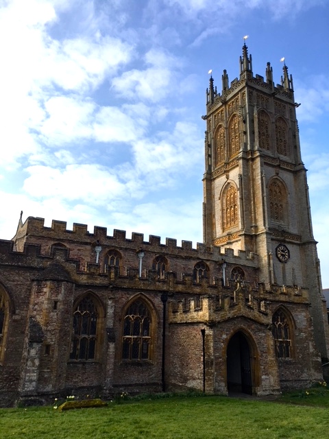
Morning church in North Petherton
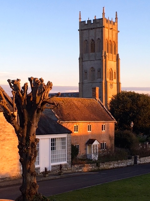
Evening church in Long Sutton
Black Dog Tails
After serving with Navy SEAL Jon Tumilson in Aghanistan, Hawwkeye remained at his side to the end.
![]()


Never mind the lovely farm mutt, watch out for the teazels… they are carnivores!
What, like weazels or wombles?!
Looks like you can start heading north again now. You had a much more representative look at the Somerset Levels than I did going through Bridgewater and up to Cheddar.
Can’t wait to hold the map the right way up! Castle Cary is a beautiful place to start the Macmillan Way proper from.
Another wonderful story of a day well spent.
Hope you had an evening of warm fires, yummy food and a comfortable bed.
much love from us all xx
The Devonshire Arms in Long Sutton totally delivered, on all fronts! Looking forward to seeing your boys next week. xx
Hi Jules,
Your post today was fascinating and your photo of the fading sun on the tower so beautiful! Isn’t the spring light wonderful, so clear. I hope your feet and boots are now dry?
Xx
Everything dry today, Donna! But I fear snow is on its way for Easter!! xx
Oh what a sad black dog story..rending.
On a lighter note – visions of Benny Hill came to mind thinking of you navigating the damp field enroute to the Devonshire Arms! Gorgeous churches. Xx
Benny Hill! You are so right! If it had been recorded and speeded up, that’s just what I would have looked like! xx
Great to meet you today, we were so impressed with your quest and will keep an eye on your progress. You never know our paths may Cross again when you are up in Scotland. Enjoy your stroll Rick, Dee, Monty and Millie (our black dog)
It was lovely meeting you all today! Thank you so much for your donation .. I do hope I see you up in Scotland!
Really great to have met you in Charlton Adam soon after your lunch at the Fox and Hounds pub. I am the person who was walking my dog, Jasper. Saw Rick and Dee’s post about you and the photograph they took. So glad they gave your website and blog details. I have read a lot of it and am fascinated and impressed. Your charcoal illustrations are beautiful and delicate. Your portraits full of character. I might make a donation to SANE in your name. I myself, am no stranger to depression, but since returning home from southern California, am no longer plagued by the Black Dog. Loneliness at times, but depression – no. I walk Jasper six times a week and am certain that the good clean air and lovely south Somerset countryside have aided in my recovery. Unfortunately the climate is not good for my damaged lungs, but that is only four or five times a year. Jasper is walked by my wonderful helper once a week and given a bit of training too. You will be in my thoughts and prayers as you make your way ever northwards. God bless and keep you safe. xxxx Anthea and Jasper 😇🦋🦋🌺🌦⛈
Hello Anthea, how wonderful of you to take the time to get in touch and say such kind things about the blog. So many people are touched by depression .. it’s the reason I’m doing the walk: to help raise awareness and chip away at the taboo that surrounds talking about mental health. I’m so sure you’re right that getting out, walking in the countryside is a significant help. It would be terrific if you would like to donate to SANE, it’s an excellent charity .. the link is on the blog, as I’m sure you’ve seen. Thank you, Anthea. My best, Jules
Loved Frannie’s Benny Hill idea, I can hear the music and see you whizzing around! Adam is so hooked, he sounded so disappointed the other day ‘oh it must be a rest day there’s no blog’ You really are entertaining a lot of us, ‘backseat ‘ walking with you !
Lovely to hear, Shauna. Your messages are really encouraging .. walked my feet off today and found your message really energising. Thank you. x
Really enjoying your daily blogs, Jules – and well done for your efforts. I live in Tasmania, have friends in Sydney (hence how I came to pick up the blog) but lived in the West Country until I was 18. Really enjoying seeing places I know so well – and reading your interesting historical research. And today’s Black Dog Story photo just made me cry. Keep on walking!
Hello Lindsay .. your comment was very timely as today has felt particularly tough. Great to get your encouragement! Thank you so much.
Very sad dog story Jules, but such a beautiful example of dedication and loyalty from an animal to his owner . Wet feet … humm… practical question , do you find that every B&B where you stay have the facilities to dry your clothes/shoes ? No fun to treck when your feet are wet . So happy to see the sun is shining and the snow has melted .. hence why it’s all so wet … big hugs xox
All the B&Bs have radiators, which I use to dry clothes and shoes at the end of the day. You’re right about wet shoes not being fun and while mine have been mostly great, having to cross ankle-deep puddles has let the water in. I’m sure that’s why I developed a blister yesterday and why my feet are quite sore at the moment. Hopefully the rest day is going to help. xxx